Wildfire Detection for the Agencies That Can't Afford to Miss It.
Satellite data from MTG and NASA FIRMS, fused and risk-scored. Automated alerts to operational personnel. No infrastructure required on your side.
Contact Us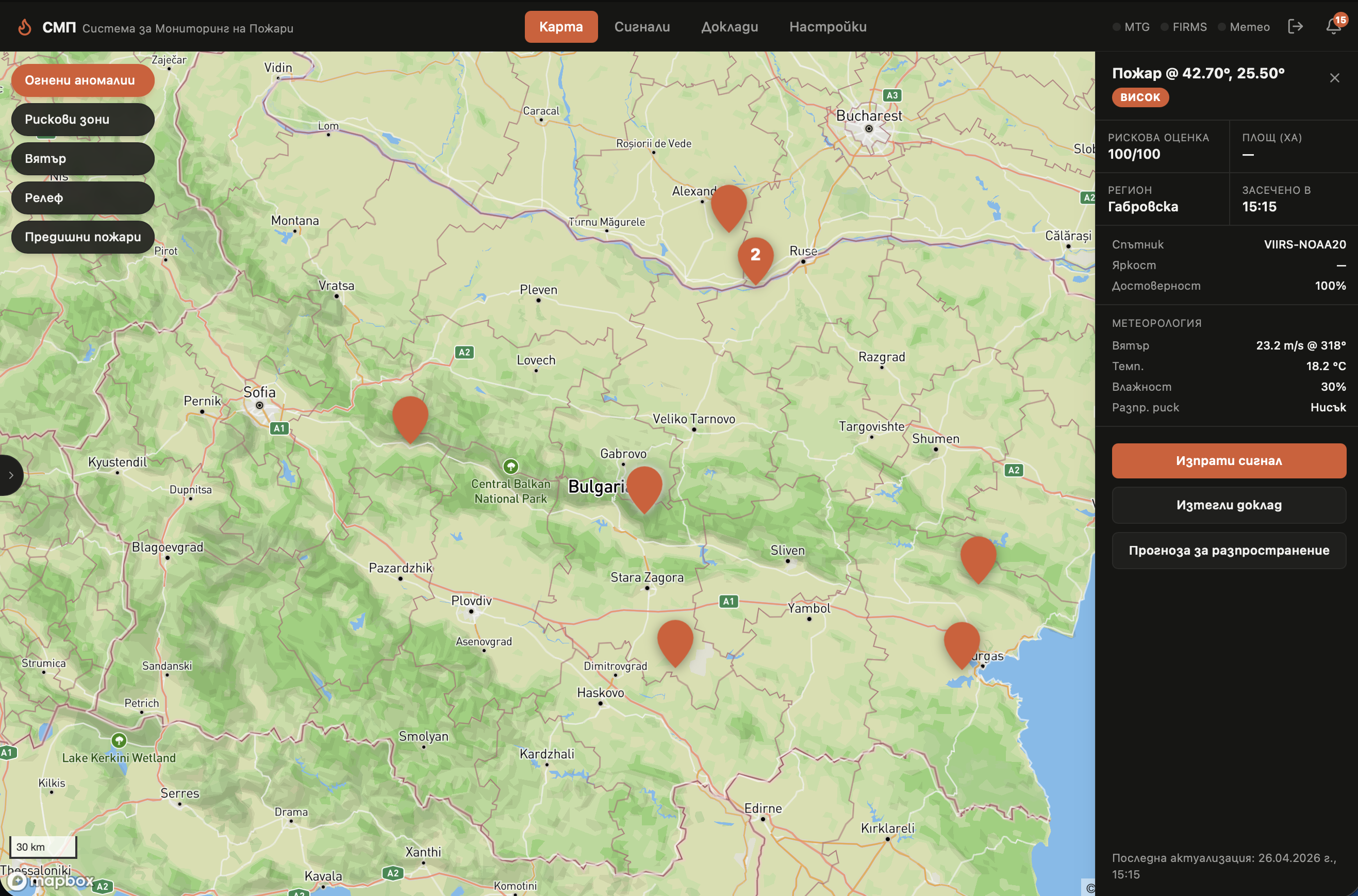
What FMT Does
Detection
Active fires detected across Bulgaria within minutes of ignition — cross-validated across independent satellite sources before any alert is sent. High-confidence detections enter an operator review queue where dispatchers can confirm or dismiss before escalation.
Risk Scoring
AI-driven risk levels per region, weighted against NDVI vegetation stress data from Sentinel-2 and current conditions.
Alerting
High-confidence detections trigger automated email alerts to pre-configured recipients — before ground observers have visual contact.
Spread Prediction
When a fire is confirmed, FMT projects its likely perimeter at 30, 60, and 120 minutes using the Rothermel rate-of-spread model, adjusted for wind speed, wind direction, and local fuel class derived from land-cover data. Spread ellipses are displayed on the map in real time.
Data Sources
MTG (Meteosat Third Generation)
Geostationary observation from EUMETSAT, providing frequent thermal imaging across the full Bulgarian territory.
NASA FIRMS
Fire Information for Resource Management System — active fire detections from the VIIRS and MODIS instruments, used as an independent cross-check.
Sentinel-3 (Copernicus)
SLSTR Fire Radiative Power from the EU Copernicus programme. A polar-orbiting active-fire detection stream that measures fire intensity (radiative power) and corroborates detections from MTG and NASA FIRMS.
Sentinel-2 (Copernicus)
High-resolution multispectral imagery from the EU Copernicus programme, used to derive NDVI vegetation stress for regional risk scoring.
Who It's For
Fire Safety Directorates (РДПБЗН)
Satellite confirmation of active fires before the first civilian call. Monitored areas, configurable alert recipients, and detection logs for incident documentation. Nearest available fire stations are automatically routed to any confirmed detection, with estimated drive times, so dispatch decisions start with real data.
Forestry Agencies (ИАГ)
Seasonal vegetation stress analysis from Sentinel-2 identifies high-risk zones before fire season peaks. Combine with real-time detection for full-season coverage.
Grid Operators (EVN and similar)
Know immediately when an active fire is detected in proximity to infrastructure. Correlate fire location with asset maps to prioritise response.